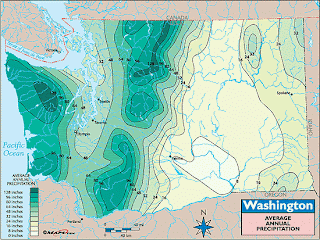
Isohyets are maps that use isolines to connect points that have the same amount of rainfall or precipitation. The term Isohyet can be used interchangeably with Isoline when the map is representing rainfall or precipitation.
The map shown is an Isohyet Map showing the "Washington Average Annual Precipitation". The map connects the points of equal precipitation. The lines are enhanced by teal shading. The lighter the color the less precipitation falls annually in that area; the darker the color the more precipitation falls annually in that area.
http://qnhn.wordpress.com/

No comments:
Post a Comment